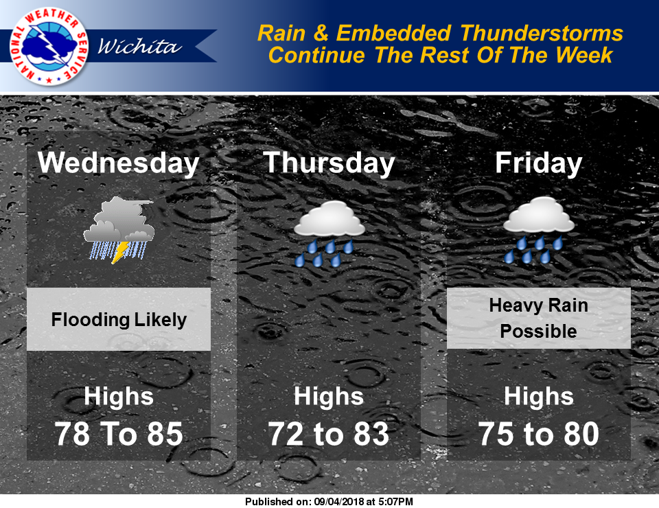
According to the National Weather Service office in Wichita, a Flash Flood Watch remains in effect for all of Central and South-Central Kansas until 1 p.m. CDT Wednesday.
Numerous showers and embedded thunderstorms are likely from Wednesday through Friday night. More heavy rains are possible and would cause flooding in some areas. The potential for heavy rains occurring is increasing, especially for Southeast Kansas Friday and Friday Night.
With the continued threat of flooding, forecasts should be monitored closely!
Wednesday
Scattered showers and thunderstorms, then showers likely and possibly a thunderstorm after 11am. Some of the storms could produce heavy rainfall. Cloudy, with a high near 80. Calm wind becoming north 5 to 8 mph in the afternoon. Chance of precipitation is 60 percent.
Wednesday Night
A 50 percent chance of showers and thunderstorms. Cloudy, with a low around 65. North northeast wind 8 to 11 mph.
Thursday
A 40 percent chance of showers and thunderstorms. Cloudy, with a high near 74. North northeast wind around 9 mph.
Thursday Night
A 40 percent chance of showers and thunderstorms. Cloudy, with a low around 64. North northeast wind 6 to 8 mph.
Friday
A 40 percent chance of showers and thunderstorms. Cloudy, with a high near 75.
Friday Night
A 40 percent chance of showers and thunderstorms. Cloudy, with a low around 64.
Saturday
A 40 percent chance of showers and thunderstorms before 2 p.m. Mostly cloudy, with a high near 76.