 After enjoying a lovely, sunny Sunday, it looks like we’re in for wind and colder temperatures in the next few days.
According to the National Weather Service in Wichita (NWSW), we also have a slight chance for rain between 2-3 a.m. Monday. Also, Monday is expected to be wind, with a north northwest wind at 18 to 23 mph increasing to 27 to 32 mph in the afternoon. Winds could gust as high as 43 mph.
Additionally, temperatures are expected to fall to 25 by 5 p.m. Monday. The overnight low is expected to be around 17. Wind speeds are expected to drop a bit, with a north-northwest wind at 5 to 15 mph becoming southwest after midnight. Winds could gust as high as 20 mph.
Tuesday is expected to see a high near 34 with a west wind of 10-13 mph then switching to a north wind in the afternoon. Winds could gust as high as 21 mph.
Tuesday night will see us in a deep freeze, with the low expected to be near 6. If you haven’t already, please be sure to bring your pets indoors Tuesday night.
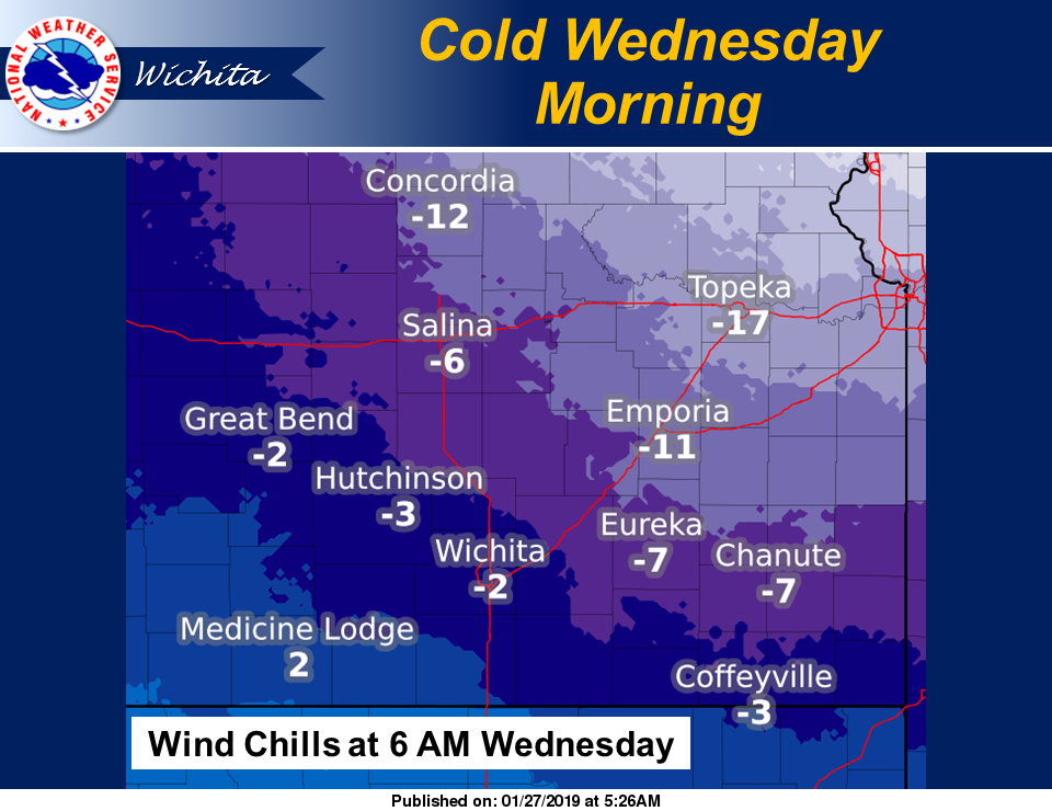
Expected sunny conditions on Wednesday won’t put much of a dent in the cold, as the early morning wind chill is expected to be near -6 and the high is forecast to be near 18. Wednesday night, the low is expected to be near 9.
Temperatures are expected to start heading back up on Thursday, with a high near 34. By the weekend, the high is forecast to be in the low 50s.