 Rainfall varied throughout the region overnight. Central Salina saw an inch of rain, as did the Salina Airport, however in southeastern Salina at the Eagle Communications studios, .56 of an inch fell.
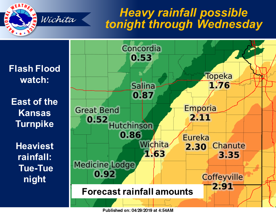
Additional rain, with some hail is expected through Wednesday, according to the National Weather Service. Flash flooding is also a possibility with some of the storms, though the heavier amounts of rain are expected further east and southeast.
Following are some overnight rain totals from weather stations in the area, as of 7 a.m. Monday, for our area.
CLAY COUNTY
12.4 miles north-northeast of Clay Center, 1.20 inches
6.7 miles west-southwest of Clay Center, 0.54 of an inch
DICKINSON COUNTY
4.5 miles west of Herington, 1.06 inches
0.3 of a mile south of Hope, 1.03 inches
10.3 miles south of Abilene, 1.26 inches
ELLSWORTH COUNTY
5.5 miles west of Brookville, 1.04 inches
6.2 miles north-northwest of Holyrood, 1.22 inches
4.5 miles northeast of Kanopolis, 1.05 inches
MARION COUNTY
0.2 of a mile northeast of Marion, 1.91 inches
8.5 miles southwest of Hillsboro, 2.44 inches
McPHERSON COUNTY
5.6 miles west of Lindsborg, 1.39 inches
0.9 of a mile west-southwest of Inman, 1.69 inches
1.5 miles northeast of Galva, 1.71 inches
3.2 miles north of Canton, 1.51 inches
4.8 miles west of Moundridge, 2.18 inches
MITCHELL COUNTY
6.9 miles northeast of Beloit, 0.44 of an inch
9.5 miles east of Hunter, 1.05 inches
OTTAWA COUNTY
7 miles north-northwest of Ada, 0.85 of an inch
REPUBLIC COUNTY
4.2 miles north of Belleville, 0.03 of an inch
SALINE COUNTY
7 miles north of Salina, 0.72 of an inch
2.9 miles northeast of Salina, 1.02 inches
3.5 miles northeast of Assaria, 1 inch
1.8 miles southeast of Culver, 1.07 inches
1.1 miles northeast of Gypsum, 1.42 inches
0.7 of a mile south-southwest of Salina, 1.04 inches