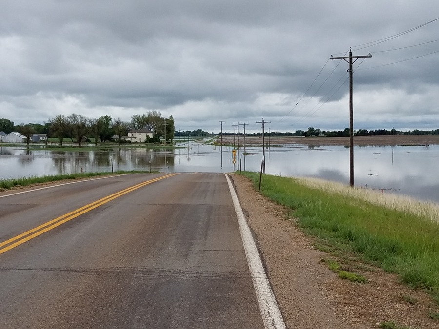
UPDATED at 4:22 p.m. Wednesday: Just within the last few minutes, a Saline County Sheriff’s deputy called into the dispatch center asking that the Kansas Department of Transportation close a portion of Kansas Highway 140 (K-140) west of Salina because of rapidly rising water. Interim Saline County Emergency Management Director Bernie Botson said K-140 would be closed at Burma Road. Flooding also was reported nearby near the intersection of Halstead Road and State Street.
Recent rains have caused flooding in parts of Saline County and throughout the area.
Saline County Sheriff’s Lieutenant Scott Anderson said Wednesday morning that because of flooding, Kansas Highway 4 (K-4) from U.S. 81 to near the Tinkler Road intersection has been closed to through traffic. He noted, however, that persons needing to get to and from Gypsum could still do so, however, K-4 going south out of Gypsum is closed to all traffic.
USD 306 canceled school Wednesday because of flooding in the southern part of the county.
City of Salina prepares to close roads/streets
Additionally, flooding of rural roads and fields could be seen throughout the county.
Saline County Undersheriff Brent Melander issued a reminder to drivers to pay heed to road-closed signs marking flooded or extremely muddy roads. He said persons caught driving past the signs or getting stuck beyond the signs will be ticketed.
See overnight rainfall totals for the area
According to the National Weather Service (NWS), all of Saline and McPherson counties, as well as parts of Clay, Dickinson, Ellsworth, Lincoln, Marion, and Ottawa counties are now under flood warnings.
Traffic was still allowed on a flooded K-4 Wednesday morning.
CLAY COUNTY
Republican River — A flood warning continues for the Republican River at Clay Center until late Friday night. At 10:30 a.m. Wednesday the river was at 18.6 feet. Flood stage is 15.0 feet. Minor flooding is occurring and additional minor flooding is forecast. The river is expected to fall to below flood stage by Friday afternoon.
DICKINSON COUNTY
Chapman Creek — A flood warning continues for Chapman Creek near Chapman until Friday evening. At 9:45 a.m. Wednesday, the river was at 20.8 feet. Flood stage is 19.0 feet. Minor flooding is occurring and additional minor flooding is forecast. The river will continue rising to near 22.0 feet by early Thursday morning. The river is expected to fall below flood stage Friday morning.
Smoky Hill River — A flood warning continues for the Smoky Hill River near Enterprise until late Sunday night. The river is expected to rise above flood stage (26.0 feet) by Wednesday afternoon and continue to rise to near 31.8 feet by Thursday morning. The river is expected to fall below flood stage by early Sunday afternoon.
Solomon River — A flood warning continues for the Solomon River near Niles until Saturday morning. The river was expected to rise above flood stage (24.0 feet) by late Wednesday morning and continue to rise to near 28.5 feet by early Thursday afternoon. The river is expected to fall below flood stage by Friday evening.
Additionally, NWS noted that roadways in much of Dickinson County were flooding, including K-4 near Hope. Radar indicated that two to three inches of rain fell across the area overnight, NWS reported.
LINCOLN COUNTY
Saline River — A flood warning continues for the Saline River near Lincoln until Thursday afternoon. The river is expected to rise above flood stage (30.0 feet) by late this afternoon and continue to rise to near 31.0 feet by this evening. The river is expected to fall below flood stage by early Thursday morning.
Salt Creek — A flood warning has been issued for late Wednesday night to late Saturday night for Salt Creek at Barnard. The creek was expected to rise above flood stage (21.0 feet) Wednesday morning and continue to rise to near 22.2 feet by early Thursday afternoon. The creek is expected to fall below flood stage by late Saturday morning.
MARION COUNTY
Cottonwood River — A flood warning continues for the Cottonwood River near Florence until Friday afternoon. At 7:15 a.m. Wednesday, the river was at 26.4 feet. Flood stage is 22.0 feet. The river will continue rising to near 27.0 feet by early Thursday morning. The river is expected to fall below flood stage early Friday morning.
Additionally, NWS noted that numerous roads in the county were experiencing flooding due to the excessive rainfall the last couple of days.
McPHERSON COUNTY
Smoky Hill River — A flood warning continues for the Smoky Hill River at Lindsborg until Thursday afternoon. At 9:30 a.m. Wednesday, the river was at 21.1 feet. Flood stage is 21.0 feet. The river is expected to continue rising to near 24.0 feet by Wednesday afternoon. The river is expected to fall below flood stage early Thursday morning.
Additionally, NWS noted that numerous roads in the county were experiencing flooding due to the excessive rainfall the last couple of days.
OTTAWA COUNTY
Salt Creek — A flood continues for Salt Creek near Ada until further notice, according to NWS. The creek is expected to rise above flood stage (18.0 feet) by late Wednesday afternoon and continue to rise to near 19.4 feet by early Friday morning.
Flooding just south of Gypsum on K-4. Videos by Randy Picking for Salina Post
SALINE COUNTY
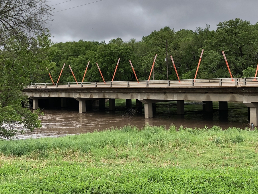
Mulberry Creek — A flood warning continues for Mulberry Creek near Salina until Thursday afternoon. The creek is expected to rise above flood stage (24.0 feet) by late this morning and continue to rise to near 27.3 feet by this evening. The creek is expected to fall below flood stage by early Thursday morning.
Smoky Hill River — A flood warning is in effect for the Smoky Hill River near Mentor from Wednesday evening until Friday morning. the river is expected to rise above flood stage (20.0 feet) by Wednesday evening and continue to rise to near 21.7 feet by Thursday morning. The river is expected to fall below flood stage by Thursday evening.
Smoky Hill River — A flood warning continues for the Smoky Hill River near New Cambria until late Friday night. The river is expected to rise above flood stage (27.0 feet) by late Wednesday afternoon and continue to rise to near 31.1 feet by early Thursday afternoon. The river is expected to fall below flood stage by Friday early afternoon.
Additionally, NWS noted that numerous roads in the county were experiencing flooding due to the excessive rainfall the last couple of days.
[ngg src=”galleries” ids=”22″ display=”basic_slideshow”]
A big thank you to KINA’s Randy Picking for all of the photos and video from the southeast part of Saline County!