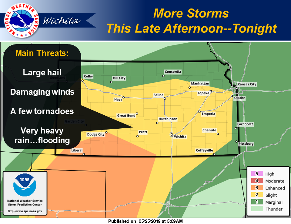
 Another round of thunderstorms is expected across the region late this afternoon through tonight.
According to the National Weather Service, strong to severe storms capable of large hail, damaging winds and perhaps a few tornadoes are once again possible. Additionally, very heavy rainfall rates on top of already saturated ground will likely lead to additional flash flooding.
Widespread river flooding, some of which is significant, will continue for several days. Additional rainfall will only aggravate the current situation.
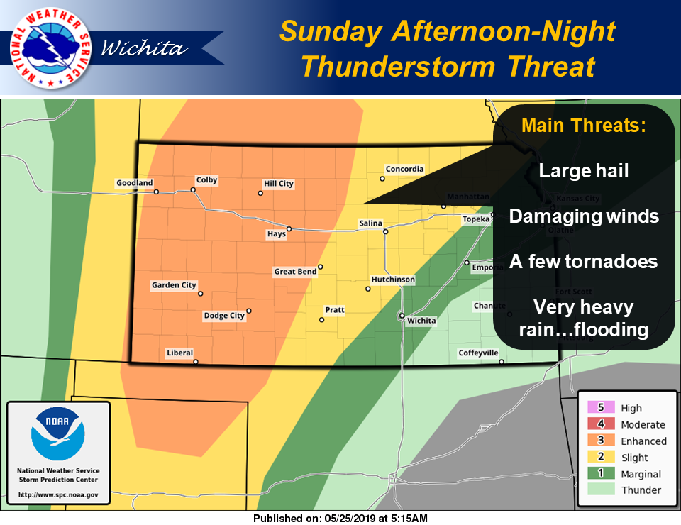 Another round of thunderstorms will impact the region Sunday afternoon and night, with the greatest chances generally along and west of the Kansas Turnpike corridor. Severe thunderstorms capable of all hazards are possible, along with pockets of very heavy rainfall and localized flash flooding.
There is a conditional threat for a few severe thunderstorms Monday evening, generally west of Interstate 135. If a storm or two can manage to develop, all severe weather hazards will be possible.
Another round of scattered to numerous thunderstorms is expected Tuesday afternoon and night across mainly eastern Kansas. All severe hazards are once again possible, along with very heavy rainfall and localized flash flooding.