 Scattered to numerous thunderstorms are expected through about mid-morning across the region, according to the National Weather Service.
Large hail is possible with the strongest storms. Additional heavy rainfall is likely, which may lead to localized flash flooding.
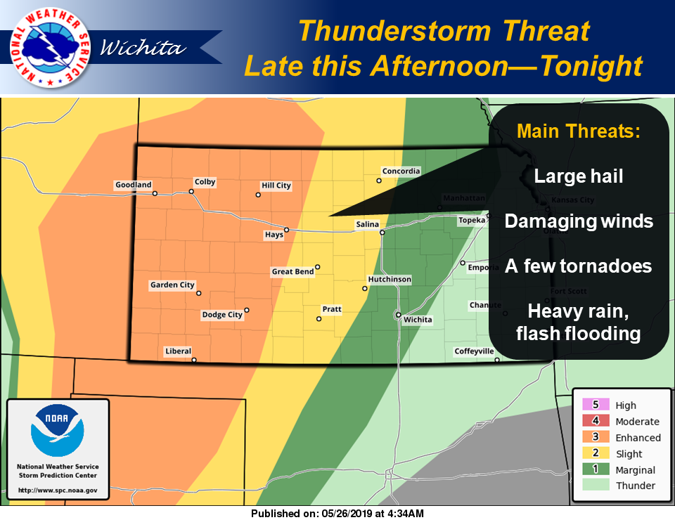
Another round of thunderstorms will impact the region mainly late this afternoon through tonight, with the greatest chances generally along and west of the Flint Hills corridor. The greatest potential for severe weather will be across central, north-central and south-central Kansas. Large hail and damaging winds will be the main threats, although an isolated tornado cannot be ruled out. Additional heavy rainfall and localized flash flooding is likely.
 Widespread river flooding, some of which is significant, will continue for several days. Additional rainfall will only aggravate the current situation.
There is a conditional threat for a few severe thunderstorms Monday evening west of Interstate 135 (I-135). If a storm or two can manage to develop, all severe weather hazards will be possible.
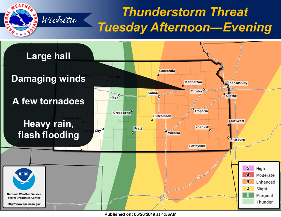
Another round of scattered to numerous thunderstorms is expected Tuesday afternoon and night, generally along and east of I-135. All severe hazards are once again possible, along with heavy rainfall and localized flash flooding.
Significant and high-impact river flooding will continue well into next week.