 Happy first day of summer! To not leave anyone in doubt about the season, summer is coming in sizzling.
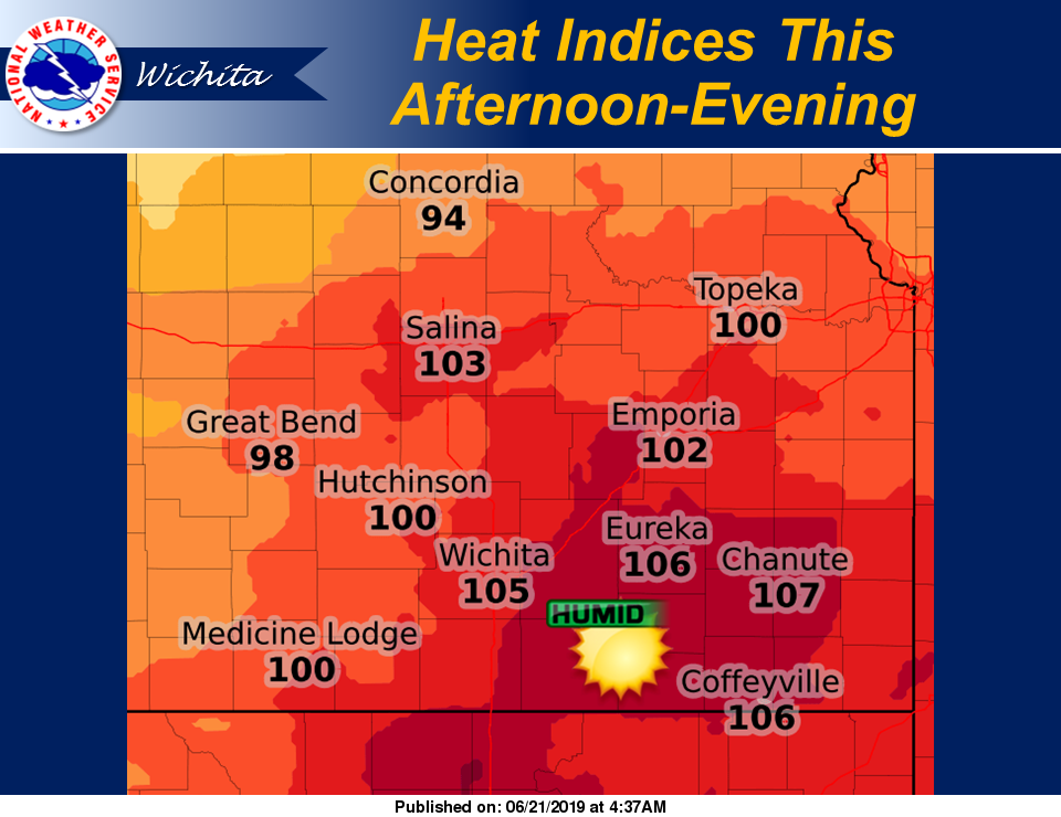
Heat indices are now expected to be around 105 degrees or greater across portions of the area this afternoon and evening. The highest values will likely be across south central and southeast Kansas.
The heat indices forecast has bounced above and below the 100 degree mark for the last couple of days, so just know that if you’re planning to be outside for very long on Friday, you need to be prepared for dangerously hot weather. Stay hydrated and try to limit your exposure to the high temperatures. Check on elderly friends and neighbors and on those who may not have air conditioning. Also, please make sure outdoor pets have plenty of fresh water and shade.
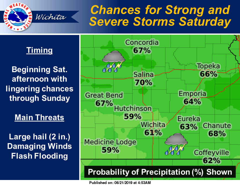 Scattered to numerous thunderstorms are expected Saturday afternoon and evening, and again Sunday afternoon and evening. Storms are likely to be strong to severe, with the main threats of large hail and damaging winds.
In addition to the severe weather threat, flash flooding will be possible as thunderstorms that develop are likely to produce very heavy rainfall rates. Rises along area rivers are also possible.