 Heat advisories remain in effect for a number of counties in our area as hot, humid weather continues. Relief, however, is in sight!
According to the National Weather Service (NWS) a heat advisory remains in effect until 9 p.m. Tuesday for the following counties in our area.
- Clay County
- Cloud County
- Dickinson County
- Ellsworth County
- Lincoln County
- Marion County
- McPherson County
- Ottawa County
- Republic County
- Saline County
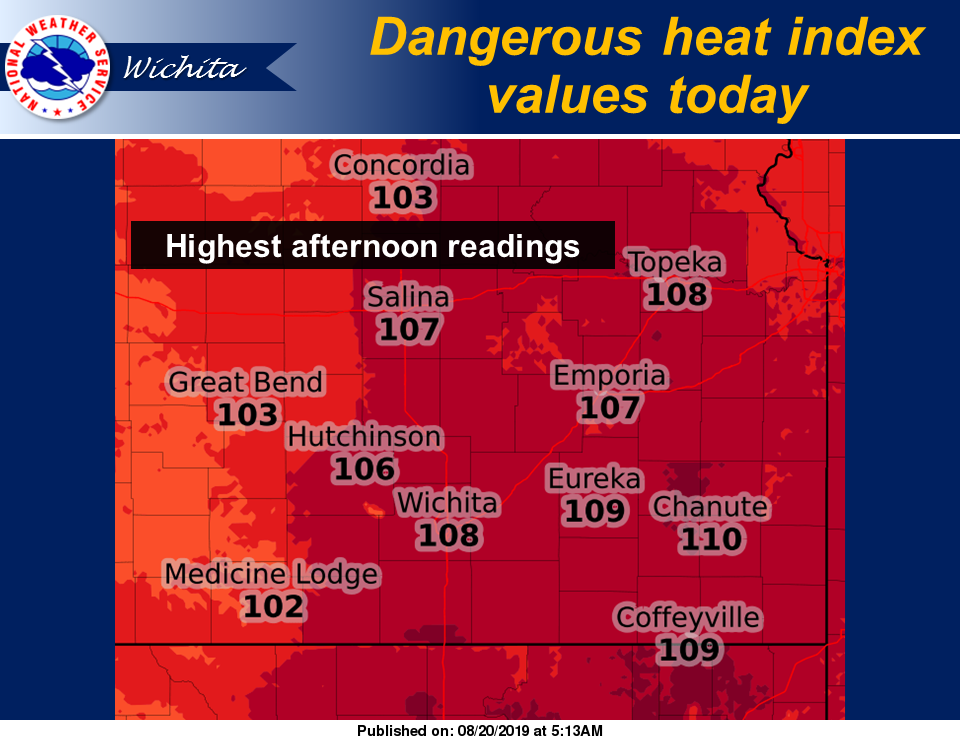
Heat index values of up to 103-110 degrees are expected.
Take extra precautions if you work or spend time outside. When possible, reschedule strenuous activities to early morning or evening. Know the signs and symptoms of heat exhaustion and heatstroke. Wear lightweight and loose-fitting clothing when possible and drink plenty of water.
A heat advisory means that a period of hot temperatures is expected. The combination of hot temperatures and high humidity will create conditions where heat illnesses are possible. Drink plenty of fluids and stay in an air-conditioned room if possible. Stay out of the sun and check up on relatives and neighbors. Temperatures within vehicles can become lethal in a few minutes. Never leave children or pets in vehicles. Remember to beat the heat, check the backseat.
 After today, temperatures are expected to drop into the 80s for a few days.
Additionally, NWS has reported that storms are expected this evening and overnight for mainly central Kansas. The stronger storms will be capable of hail up to nickel size, 50 mph winds and heavy rain.
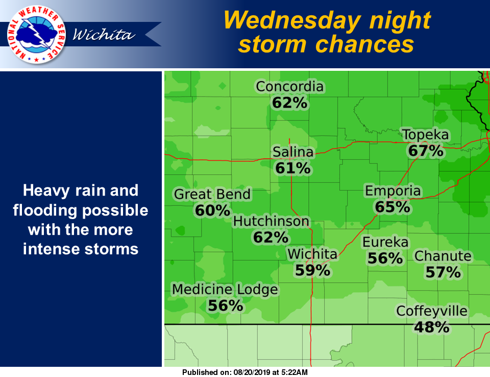
Storms are expected Wednesday through Thursday night. The best chance for widespread storms will be for Wednesday night, especially for eastern Kansas. While a strong to marginally severe storm can`t be ruled out through this period, the main threat looks to be heavy rain and flooding.