 It looks to be a damp weekend in the area.
According to the National Weather Service, strong to severe storms are possible over central and south central Kansas this evening and tonight.
Storms are more likely late tonight, roughly west of a line from Lincoln to Hutchinson to Harper. An isolated severe storm cannot be ruled out. A few storms also may be strong with locally heavy rain, small hail and winds to 50 mph.
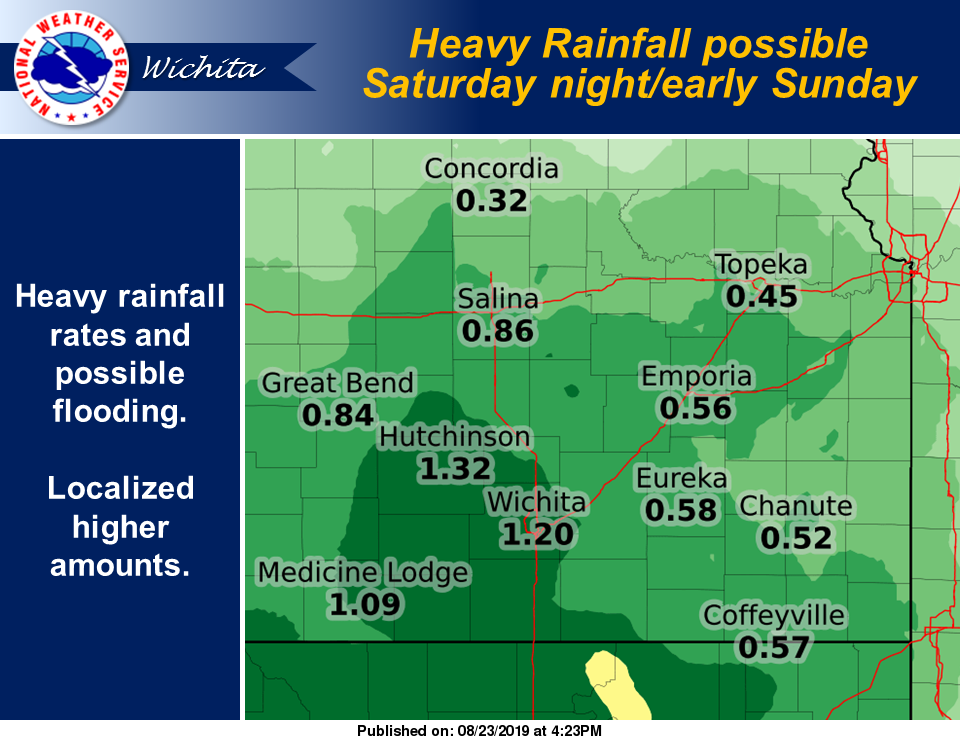
Showers and thunderstorms are in the forecast for Saturday through Tuesday, but the greatest severe weather threats will be over the weekend. One or more rounds of strong to severe storms and flood producing heavy rain is probable over the weekend. However there is considerable uncertainty in the details, with much depending on how storms evolve late tonight. At this point, the threat for heavy rain and flooding is highest Saturday night and Sunday morning especially over central and south central Kansas.