 A flash flood watch has been issued for our area.
Large part of state under severe thunderstorm watches
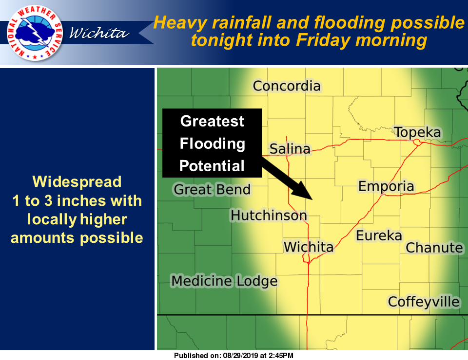
The National Weather Service has issued a flash flood watch from 10 p.m. Thursday through Friday afternoon for the following counties in our area.
- Clay County
- Cloud County
- Dickinson County
- Ellsworth County
- Lincoln County
- Marion County
- McPherson County
- Ottawa County
- Saline County
UPDATED: Strong to severe storms likely overnight
According to NWS, a complex of strong to severe thunderstorms with heavy rainfall is expected to develop across north-central and northeast Kansas Thursday evening and will move southeast across central and east-central Kansas overnight. Widespread 1 to 3 inches of rainfall will be possible across the watch area, with the potential for isolated higher amounts. This amount of rainfall in a short period of time could cause flash flooding across the watch area.
Flash flooding of rivers, streams, and low water crossing including some roadways could occur. Be especially careful at night and so not drive through flooded roadways.
Some rivers and creeks are currently running higher than normal and could experience quick rises with renewed flooding.
A flash flood watch means that conditions may develop that lead to flash flooding. Flash flooding is a very dangerous situation. Remember to turn around, don`t drown.