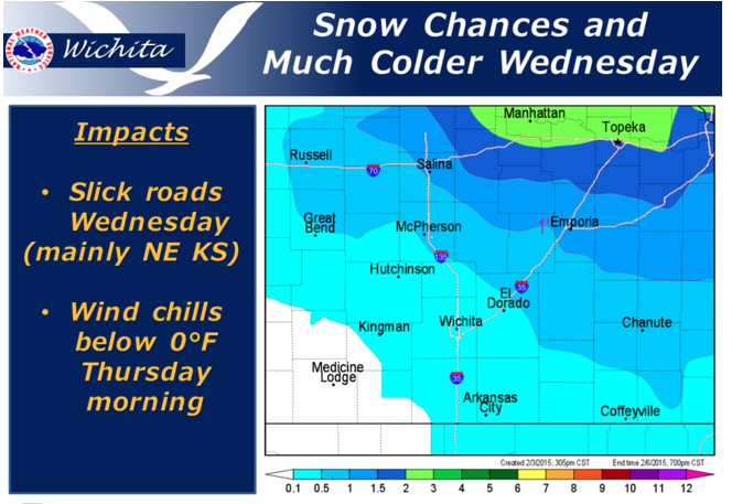
 Snow will begin Wednesday morning across northern Kansas and will spread southeast through the day on Wednesday. Light accumulations and areas of blowing snow are expected, mainly across the Northeast part of Kansas. Roads may become slick, especially untreated, elevated surfaces. A surge of cold Canadian air will accompany the snow and drop wind chills below zero across much of the area Thursday morning.
Wednesday A 40 percent chance of snow. Cloudy, with a high near 26. Blustery, with a north northeast wind 11 to 16 mph increasing to 20 to 25 mph in the morning. Winds could gust as high as 34 mph.
Wednesday Night Cloudy, then gradually becoming partly cloudy, with a low around 12. North wind 10 to 15 mph becoming light and variable. Winds could gust as high as 22 mph.
Thursday Mostly sunny, with a high near 38. South wind 6 to 11 mph increasing to 13 to 18 mph in the afternoon. Winds could gust as high as 28 mph.
Thursday Night Mostly clear, with a low around 28. South southwest wind around 13 mph.
Friday Sunny, with a high near 64.
Saturday Sunny, with a high near 72.