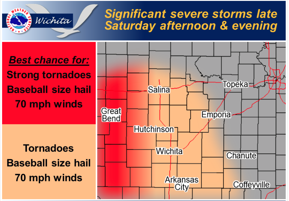
 Significant severe storms expected late Saturday afternoon and evening across central and south central Kansas. Tornadoes, hail greater than 2″ in diameter and 70 mph winds possible with the stronger storms. Locations generally west of I-135 will have an enhanced risk of strong, long-track tornadoes.
Today A 20 percent chance of showers and thunderstorms after 3pm. Partly sunny, with a high near 72. North northeast wind 7 to 11 mph.
Tonight A 50 percent chance of showers and thunderstorms, mainly after 7pm. Mostly cloudy, with a low around 61. East northeast wind 7 to 10 mph.
Saturday A 50 percent chance of showers and thunderstorms. Partly sunny, with a high near 77. Southeast wind 5 to 10 mph increasing to 13 to 18 mph in the afternoon. Winds could gust as high as 28 mph.
Saturday Night Showers and thunderstorms likely. Some of the storms could be severe. Mostly cloudy, with a low around 58. Breezy, with a south wind 17 to 24 mph, with gusts as high as 33 mph. Chance of precipitation is 60%.
Sunday Mostly sunny, with a high near 74. Breezy, with a south wind 20 to 22 mph becoming west southwest in the afternoon. Winds could gust as high as 31 mph.