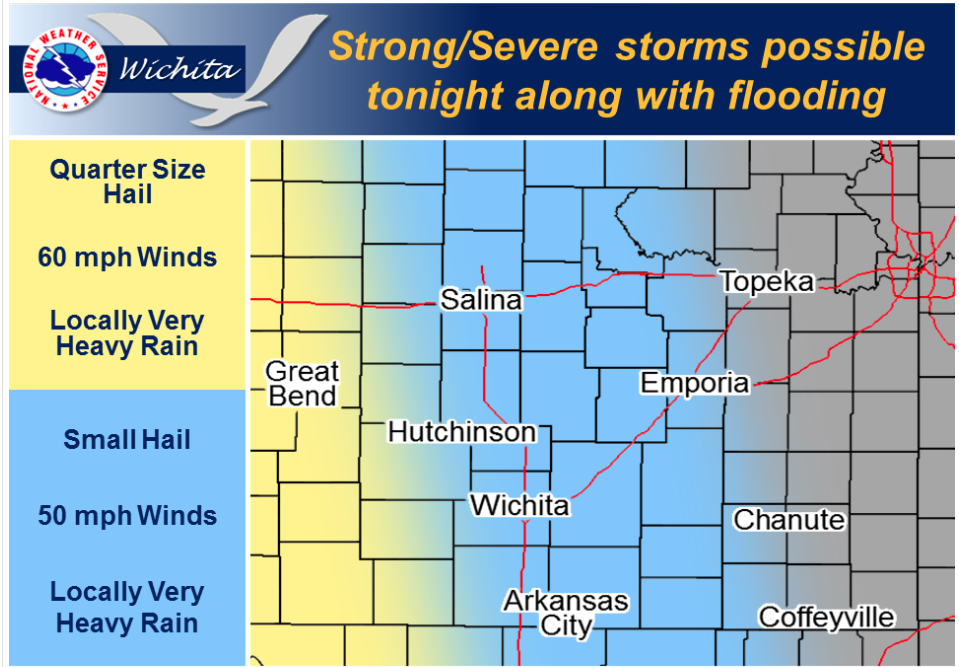
 Clusters of strong thunderstorms with brief but torrential rainfall rates will continue moving across Southeast Kansas during the morning hours. Localized flooding will be possible where storms move repeatedly over the same areas. More storms are expected to develop this afternoon and evening along a slow moving cold front. Some of these storms may become severe with 60 mph winds, half dollar sized hail and locally heavy rains.
Today A 50 percent chance of showers and thunderstorms, mainly after 11am. Mostly cloudy, with a high near 78. West wind 5 to 13 mph becoming north northwest in the afternoon.
Tonight A 40 percent chance of showers and thunderstorms, mainly before 10pm. Mostly cloudy, with a low around 56. North wind 11 to 14 mph, with gusts as high as 18 mph.
SaturdayPartly sunny, with a high near 71. North wind 11 to 17 mph, with gusts as high as 25 mph.
Saturday NightPartly cloudy, with a low around 50. Northeast wind 5 to 10 mph.
Sunday Sunny, with a high near 74. East southeast wind 5 to 10 mph.