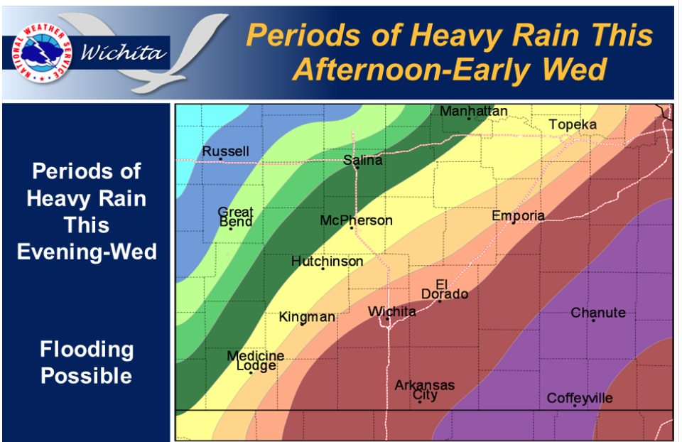
 A slow-moving cold front is expected to produce widespread thunderstorms across the area from late this afternoon through Tuesday. Locally heavy rainfall and flooding will be possible as the front pushes through a very moist and unstable airmass. Chances for storms and additional rainfall can be expected through at least Wednesday.
Today Showers and thunderstorms, mainly after noon. Some of the storms could produce heavy rainfall. High near 87. South wind 11 to 15 mph becoming northwest in the afternoon. Winds could gust as high as 22 mph. Chance of precipitation is 90%.
Tonight Showers and thunderstorms, mainly before midnight. Some of the storms could produce heavy rainfall. Low around 63. North wind 11 to 18 mph, with gusts as high as 28 mph. Chance of precipitation is 80%.
Tuesday Partly sunny, with a high near 77. Northeast wind 11 to 13 mph.
Tuesday Night A 20 percent chance of showers and thunderstorms. Mostly cloudy, with a low around 60. East northeast wind 7 to 11 mph.
Wednesday A 20 percent chance of showers and thunderstorms. Mostly cloudy, with a high near 80. North northeast wind around 8 mph.
Wednesday Night A 50 percent chance of showers and thunderstorms. Mostly cloudy, with a low around 64.