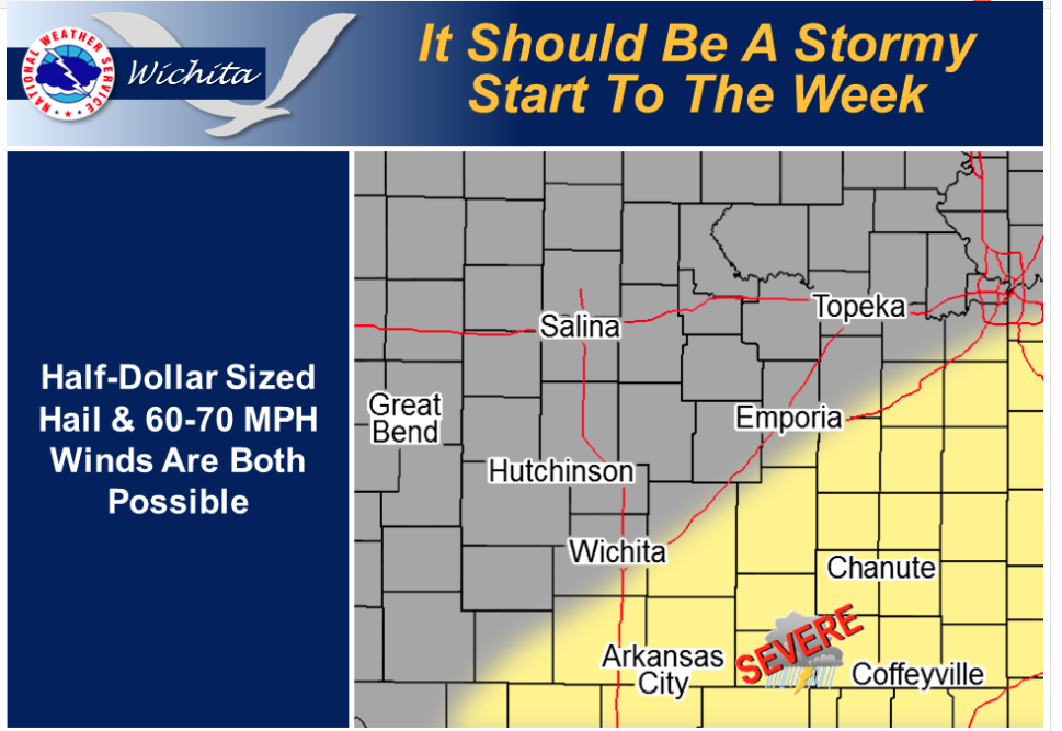
 A southeast-moving cold front will cross most of Kansas today with the front entering Southeast Kansas late this afternoon. While thunderstorms are certain for all areas, the greatest potential would be along and primarily southeast of the Turnpike where half-dollar sized hail and 60 to 70 mph winds may occur. The greatest threat for severe thunderstorms for these areas would from late this afternoon onward. For areas northwest of the Turnpike, thunderstorms would be much more scattered and less intense.
TodayA 50 percent chance of showers and thunderstorms. Mostly cloudy, with a high near 91. West northwest wind 5 to 14 mph becoming south in the morning. Winds could gust as high as 20 mph.
TonightA 30 percent chance of showers and thunderstorms, mainly before 10pm. Mostly cloudy, with a low around 69. West wind 7 to 13 mph becoming northeast in the evening.
TuesdayA 20 percent chance of showers and thunderstorms. Mostly sunny, with a high near 85. East northeast wind 7 to 14 mph, with gusts as high as 20 mph.