 Showers and storms will continue to affect areas generally northwest of the Kansas Turnpike Monday and especially Monday night. While any of the showers & storms will likely produce high rainfall rates & minor flooding, areas along & west of Highway 14 will have the greatest chance to see more substantial flooding.
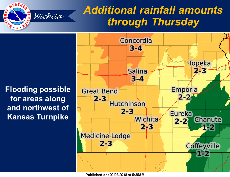
Showers and storms will remain in the forecast through Thursday. Additional rainfall amounts will range from 1 to around 4 inches, with the higher amounts along and northwest of the Kansas Turnpike. Be sure to monitor flood watches and warnings, especially if you live or travel near flood prone areas.
Five to more than six inches of rain have fallen across central and northeast Kansas as of early Monday morning. Some of the worst flooding has occurred in the Manhattan area where Wildcat Creek went out of it’s banks early Monday morning, prompting evacuations in Keats. A mudslide closed a portion of Blue River Road north of Manhattan.
The Flash Flood Watch is now in effect for
* a portion of Central Kansas, including the following areas, Barton, Ellsworth, Lincoln, Rice, Russell, and Saline.
* Through Tuesday morning.
* Intense rainfall rates are likely with storms today and especially tonight. This combined with earlier rainfall will increase the risk for flash flooding.