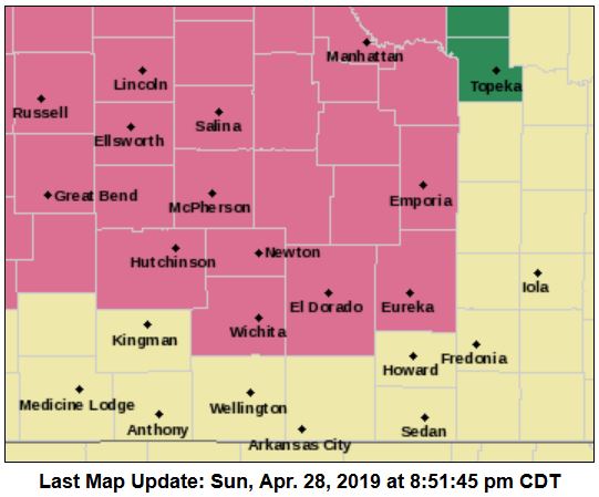
A severe thunderstorm watch is now in effect for our area.
According to the National Weather Service (NWS), the following counties in our area are in the watch, which runs until 3 a.m. Monday.
- Chase
- Clay
- Cloud
- Dickinson
- Ellsworth
- Lincoln
- Marion
- McPherson
- Mitchell
- Ottawa
- Saline
According to NWS, a cluster of thunderstorms will push east southeast across portions of central and south-central Kansas through the overnight hours. The primary threats will be wind gusts of 60-70 mph, hail up to half-dollar size, and heavy rain. A low-end tornado threat may exist, especially across south-central Kansas.