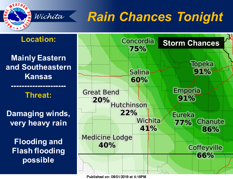
 UPDATE 4:30 p.m. Thursday: Updates rain chances map at right.
It looks like we might see some rain tonight through Friday.
According to the National Weather Service, isolated to widely scattered thunderstorms are expected to redevelop this afternoon and evening across portions of central and south-central Kansas, mainly west of the Flint Hills. While widespread severe weather is not expected, a few of the stronger storms will be capable of dime to quarter size hail and 50 to 60 mph winds, along with locally heavy rain.
Afternoon heat indices will exceed 100 degrees across portions of central and south-central Kansas, with heat indices exceeding 105 degrees across portions of south-central Kansas.
Another round of numerous thunderstorms is expected to impact northern, northeast and eastern Kansas overnight. A few of the strongest storms will be capable of large hail and damaging winds. Additionally, areas of very heavy rainfall along with pockets of flooding and flash flooding are likely.
Numerous thunderstorms will impact eastern Kansas into Friday morning, with isolated to scattered storms impacting the entire region through the day Friday.