 We have more chances for rain and thunderstorms tonight and over the next several days.
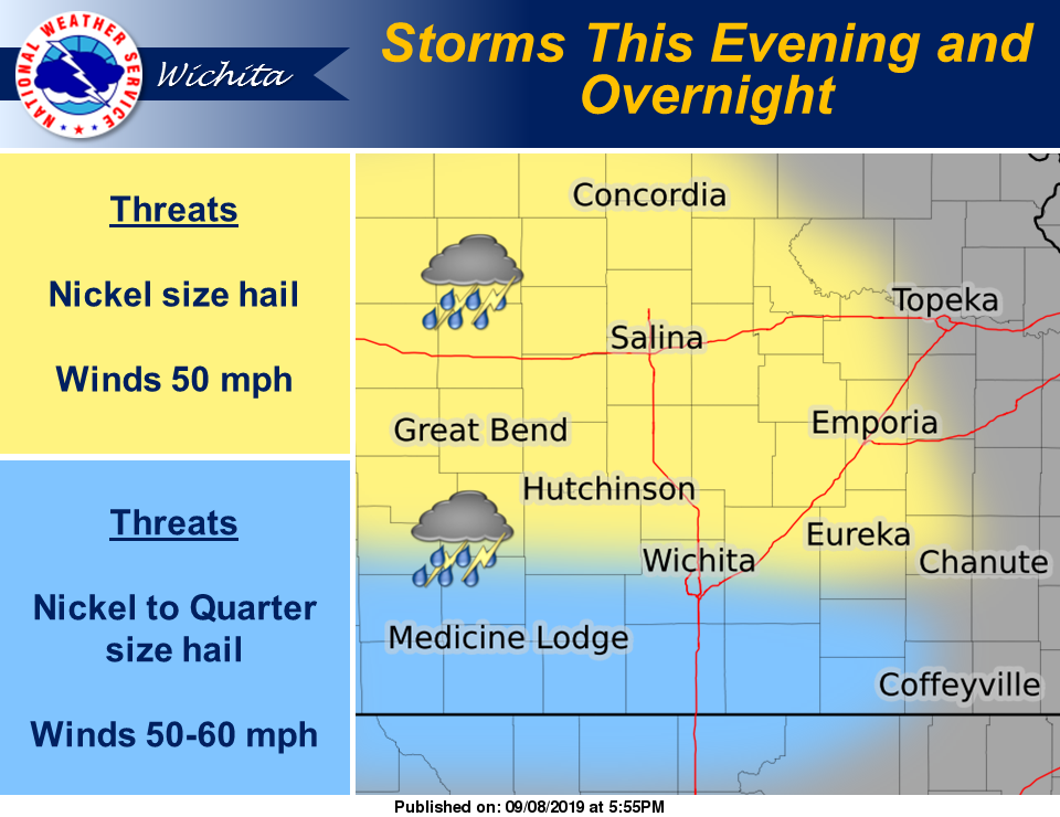
According to the National Weather Service, scattered storms may redevelop along a warm front over portions of central Kansas this evening. A few strong storms with nickel sized hail, wind gusts to 50 mph and locally heavy rain will be possible with the strongest activity. Other storms may drift eastward late tonight bringing some locally heavy rain to portions of central and south central Kansas.
Additional storms may develop across south central and southeast Kansas early this evening and be capable of quarter size hail and 60 mph
winds.
Some storms may linger across the area Monday morning but are not expected to be strong or severe.
Winds may approach advisory criteria tomorrow across portions of central Kansas. Winds will approach 30 mph and with higher gusts to near
40 mph possible.
Widely scattered storms possible late tomorrow night into early Tuesday across central and south central Kansas. A couple of storms could be strong with small hail and wind gusts to 50 mph.
A few strong to severe storms may accompany a cold front across much of the area on Thursday afternoon and Thursday evening.