Information updated by the National Weather Service at 4:46 p.m. Saturday
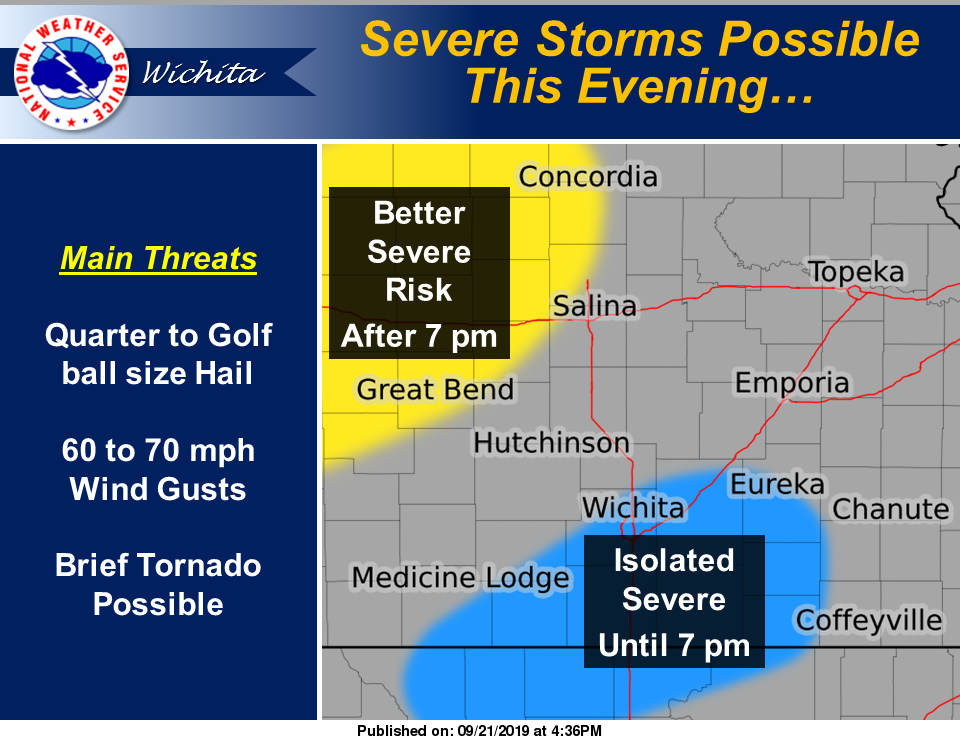
There is a risk for severe storms this evening across central Kansas and a portion of south central Kansas and the southern Flint Hills. The main threats will be quarter to golf ball size and damaging down-burst winds of 60 to 70 mph. In addition, a tornado will be possible through 9 p.m.
The main storm threat late this evening across central Kansas and late tonight across the Flint Hills and southeast Kansas will be heavy rainfall. This could result in flash flash flooding. Please refer to the Flash Flood Watch for details. A few strong storms with small hail and gusty winds can also be expected across the entire area after midnight.
NWS: Area counties in severe thunderstorm watch
More area counties in flash flood watches
In case you’re traveling to that part of the state
The risk for thunderstorms with heavy rainfall will gradually shift east from the Flint Hills into southeast Kansas on Sunday with a continued threat of flooding through early afternoon.
Next week
There will be periodic chances for thunderstorms Monday night through Thursday night. While organized severe storms are not expected with this activity, some strong storms appear possible.