UPDATE 7 a.m. Wednesday: The National Weather Service has updated the forecast and issued freeze watches for our area. To find out more, click here.
It will be more than a little brisk later in the week.
According to the National Weather Service (NWS), much colder air will overspread the region Thursday night and Friday. Light snow showers are possible across central Kansas Thursday night through early Friday. No snow accumulation expected.
Near-freezing temperatures and frost are possible during the early morning hours of Friday, Saturday, and Sunday across much of the area. Please plan on taking action to protect sensitive
plants.
Frost will be possible again in central Kansas early Monday morning.
Special weather statement for Mitchell and Jewell counties
Additionally, NWS has issued the following special weather statement for some Kansas counties, including Mitchell and Jewell.
A strong cold front will cross the region Thursday, ushering in unseasonably cold air for early October. Thursday night into Friday morning, widespread freezing temperatures will occur. Low
temperatures Friday morning will range from the middle 20s to lower 30s. This will end the growing season.
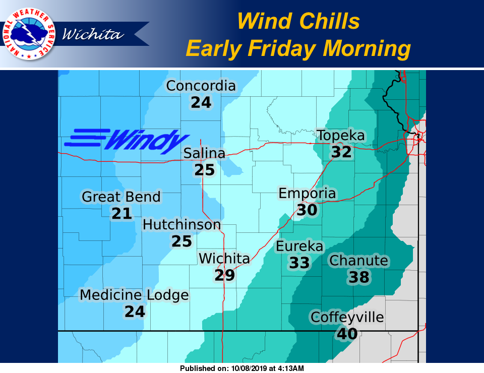
The cold air will be accompanied by strong northwest winds sustained between 20 and 30 mph Thursday and Friday, with gusts between 40 and 50 mph at times. This will result in wind chill
readings in the teens and 20s Friday morning.
The first snowflakes of the season could fall Thursday night into Friday morning at some locations…along with potential for some patchy freezing drizzle. However, little to no accumulation is expected from snow or ice.
Anyone with outdoor plants sensitive to cold temperatures will need to take precautions to protect them from being killed. Sprinkler systems could also be damaged from hours of subfreezing
temperatures. In addition, winter outerwear will be needed Friday morning.