UPDATE 6 p.m. Thursday: The National Weather Service has revised just how cold it might get overnight. Read the new story here
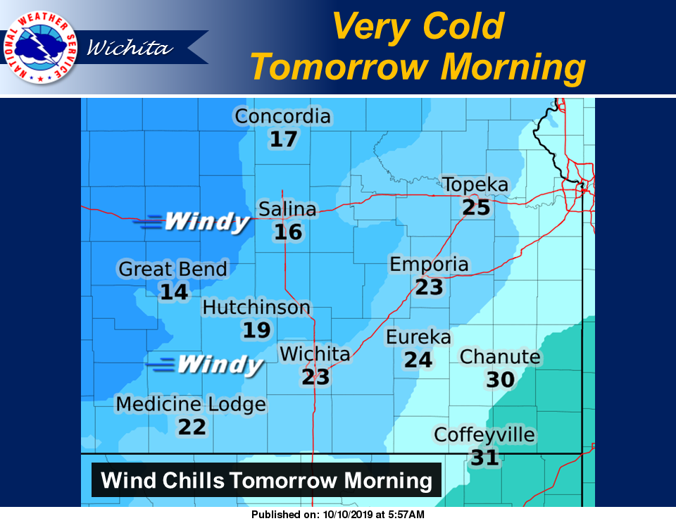
Much of the state has been placed under freeze warnings as a strong cold front moves into the area.
The National Weather Service in Wichita (NWSW) has issued a freeze warning in effect from 10 p.m. Thursday to 10 a.m. Friday for the following counties in our area. Additionally, those same counties are under a wind advisory through 7 a.m. Friday.
- Ellsworth County
- Lincoln County
- Marion County (no wind advisory issued for Marion County)
- McPherson County
- Saline County
Temperatures in the upper 20s to low 30s are expected, with winds from the northwest at 25 to 35 mph with gusts up to 40 mph.
Freezing temperatures are expected overnight Thursday night through mid morning Friday. Strong winds can be expected Thursday through Friday morning.
Sensitive vegetation may be killed or damaged if not protected or brought indoors. Northwesterly cross winds along roadways may make driving difficult.
Additionally, NWS in Topeka has issued a freeze warning in effect from 10 p.m. Thursday to 10 a.m. Friday for the following counties in our area.
- Clay County
- Cloud County
- Dickinson County
- Ottawa County
- Republic County
Temperatures are expected to drop to between 30 and 32 degrees in the warned area Tursday night. Freezing temperatures could kill outdoor plants, sensitive vegetation and crops.
NWS in Hastings, Neb., has issued a freeze warning in effect from 7 p.m Thursday to 1 p.m. Friday for the following counties in our area.
- Jewell County
- Mitchell County
Sub-freezing temperatures as low as 21 to 30 degrees expected. Freezing temperatures will kill crops, other sensitive vegetation and possibly damage unprotected outdoor plumbing.