UPDATE: The hazardous weather outlook for Clay, Cloud, Dickinson, Ottawa, and Republic counties has been dropped. The hazardous weather outlook for Ellsworth, Lincoln, Marion, McPherson, and Saline counties has been updated.
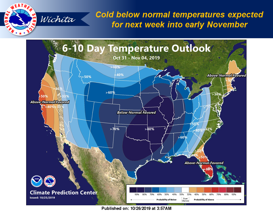
Cooler temperatures with a chance for winter weather by mid-week are in the forecast.
The National Weather Service (NWS) in Wichita has issued the following hazardous weather outlook for Ellsworth, Lincoln, Marion, McPherson, and Saline counties.
Sunday through Friday
There is a slight chance of a snow and light rain mix for portions of central and southeast Kansas on Monday into Monday night. Little or no snow accumulation is expected at this time.
Meanwhile, a stronger storm system looks to affect the entire region for Tuesday night through Thursday morning. This system will bring a chance of snow to central Kansas, and a wintry mix of
freezing rain and snow across southern Kansas. Please check for later forecast updates on any changes with this storm system.
Additionally, the NWS in Topeka has issued the following hazardous weather outlook for Clay, Cloud, Dickinson, Ottawa, and Republic counties.
Sunday through Friday
A light dusting of snow is possible Monday night, mainly on grassy areas.
Accumulating wintry precipitation is possible Tuesday night into late Thursday.