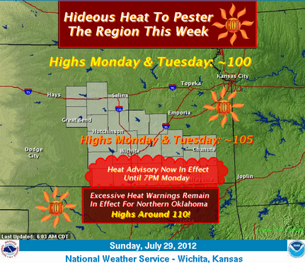
 As the graphic clearly depicts…hideous heat will continue to plague the Kansas Neighborhood this week. Northern Oklahoma will real feel the heat where highs around 110 are likely Monday & Tuesday and where…not surprisingly…an Excessive Heat Warning remains in effect. Highs around 105 are ticketed for most of Southern Kansas while Northern Kansas & most of Missouri will reach around 100. The Heat Advisory for extreme South-Central & Southeast Kansas has been extended until 7PM Monday.
- TODAY: A 20 percent chance of showers and thunderstorms after 4pm. Mostly sunny and hot, with a high near 108. South wind 6 to 11 mph becoming west southwest in the morning.
- TONIGHT: A 20 percent chance of showers and thunderstorms. Partly cloudy, with a low around 77. Calm wind becoming east southeast around 6 mph in the evening.
Official report – Saturday Night/Sunday Morning – .37″ of rain