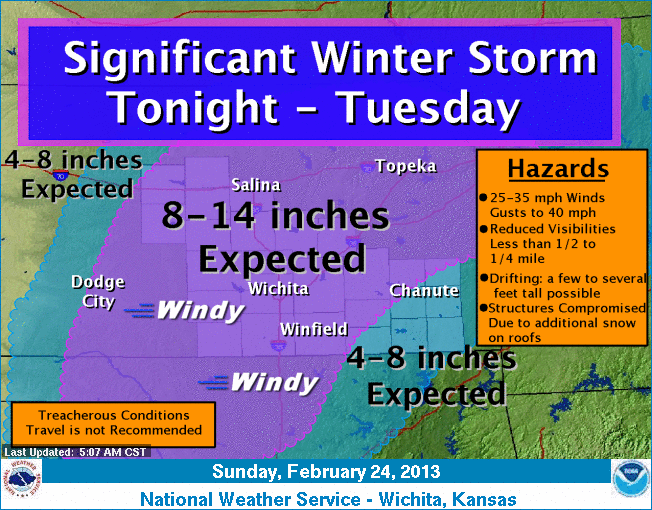
 After trending down the snow forecast early Saturday afternoon with media and emergency management officials in a conference call, National Weather Service has updated the forecast to have the approaching winter storm to pack a wallop equal to the storm Wednesday through Thursday. Here is the information from the weather service as of late Saturday afternoon.
The neighborhood is about to get walloped by another dangerous winter storm. An intense cyclone moving east across Oklahoma will spread moderate to heavy snow across the area from Sunday Night throug Monday Night. A wide range of accumulations…from between 10 and 15 inches in the PURPLE SCALLOPED AREAS to between 5 and 10 inches in the BLUE SCALLOPED AREAS are likely. Furthermore…winds will become northerly and greatly increase on Monday with sustained speeds around 25 mph along with gusts that may reach around 35 mph to reduce visibilities to less than 1/4 mile. This situation should be monitored closely!