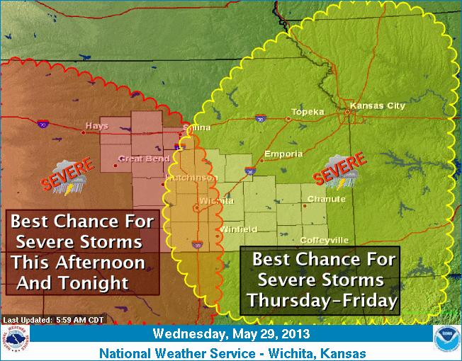
 Supercell thunderstorms are possible this afternoon and evening for locations generally west of Interstate 135. Tornadoes, large hail greater than two inches in diameter and damaging winds in excess of 70 mph will be possible.
On Thursday and Friday the severe weather threat will begin to shift southeast impacting locations along and southeast of the Kansas Turnpike.
- TODAY: A 30 percent chance of showers and thunderstorms, mainly after 4pm. Mostly cloudy, with a high near 82. Windy, with a south wind 22 to 27 mph increasing to 29 to 34 mph in the afternoon. Winds could gust as high as 45 mph.
- TONIGHT: Showers and thunderstorms likely, mainly after 9pm. Mostly cloudy, with a low around 66. Breezy, with a south wind 24 to 29 mph decreasing to 16 to 21 mph after midnight. Winds could gust as high as 38 mph. Chance of precipitation is 70%.