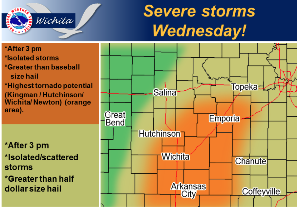
 Severe storms likely after 3 pm Wednesday. Supercell storms are expected to remain isolated with very large hail and tornadoes possible. The greatest risk for significant severe storms looks to be over South Central Kansas, including Kingman, Hutchinson, Wichita, Newton and Wellington
Today A chance of drizzle and thunderstorms before 10am, then a slight chance of showers and thunderstorms after 11am. Patchy fog before 10am. Otherwise, cloudy, with a high near 69. East northeast wind 7 to 10 mph. Chance of precipitation is 20%.
Tonight A 40 percent chance of showers and thunderstorms before 4am. Mostly cloudy, with a low around 50. East wind 8 to 16 mph becoming west southwest after midnight. Winds could gust as high as 22 mph.
Thursday A slight chance of showers between 7am and 1pm. Mostly sunny, with a high near 65. Breezy, with a northwest wind 11 to 16 mph increasing to 21 to 26 mph in the afternoon. Winds could gust as high as 36 mph. Chance of precipitation is 20%.
Thursday Night Mostly clear, with a low around 35. Breezy, with a west northwest wind 17 to 22 mph decreasing to 7 to 12 mph after midnight. Winds could gust as high as 30 mph.
Friday Sunny, with a high near 68. Northwest wind around 8 mph becoming south southwest in the afternoon.