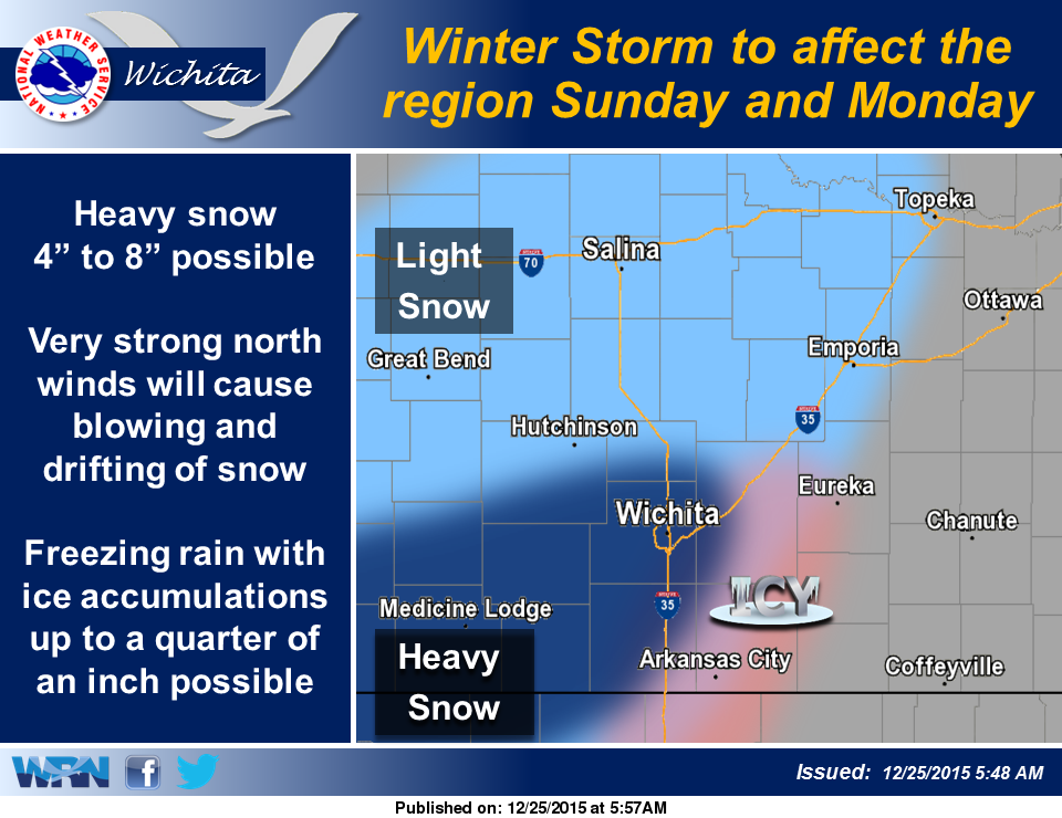
 A strong winter storm system is expected to develop and move northeast across the region for mainly Sunday and Monday. A period of freezing rain and sleet could result in icy conditions across south central Kansas near the Kansas turnpike, with heavy snow possible just west of interstate 35. In addition the strong north winds will cause blowing and drifting of snow.
Christmas Day – Cloudy, with a high near 44. Light and variable wind becoming east southeast 9 to 14 mph in the afternoon. Winds could gust as high as 20 mph.
Tonight – Mostly cloudy, with a low around 37. East southeast wind 7 to 13 mph becoming south after midnight.
Saturday – A chance of rain after 7 a.m., mixing with snow after 4 p.m. Cloudy, with a high near 39. Breezy, with a west southwest wind 6 to 11 mph becoming north northwest 18 to 28 mph. Winds could gust as high as 37 mph. Chance of precipitation is 30%.
Saturday Night – A chance of rain and snow before 8pm, then a slight chance of snow. Areas of blowing snow after 1am. Cloudy, with a low around 23. Windy, with a north wind 28 to 30 mph, with gusts as high as 39 mph. Chance of precipitation is 30%.
Sunday – A 20 percent chance of snow. Areas of blowing snow. Mostly cloudy, with a high near 28. Blustery, with a north northeast wind 23 to 28 mph, with gusts as high as 37 mph.
Sunday Night – A 40 percent chance of snow, mainly after 7 p.m. Areas of blowing snow. Mostly cloudy, with a low around 20. Blustery.
Monday – A 50 percent chance of snow. Areas of blowing snow before 1 p.m. Mostly cloudy, with a high near 28. Blustery.
Monday Night – A 50 percent chance of snow. Mostly cloudy, with a low around 18.
Tuesday – A 30 percent chance of snow before 7 a.m. Partly sunny, with a high near 29.
Tuesday Night – A 20 percent chance of snow after 7 p.m. Mostly cloudy, with a low around 17.
Wednesday – A 20 percent chance of snow. Partly sunny, with a high near 31.
Wednesday Night – Partly cloudy, with a low around 16.
Thursday – Sunny, with a high near 32.