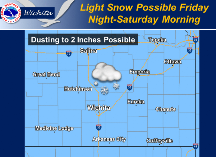
Another storm system is expected to spread areas of light snow across the region Friday night through Saturday morning. There remains some uncertainty surrounding this system, but current indications support snow accumulations of a dusting up to 2 inches across the region. Stay tuned as we continue to refine the forecast details.
 Today Rain. Areas of dense fog. High near 42. East southeast wind 6 to 8 mph. Chance of precipitation is 80%.
Tonight Rain likely, mainly before 3am. Patchy fog before 7pm. Otherwise, cloudy, with a low around 34. East northeast wind 6 to 11 mph becoming north northwest after midnight. Chance of precipitation is 60%.
Friday A chance of rain and snow before 11am, then a chance of rain. Cloudy, with a high near 39. North northwest wind 11 to 13 mph. Chance of precipitation is 30%.
Friday Night A chance of rain before 7pm, then rain and snow likely between 7pm and 9pm, then snow likely after 9pm. Cloudy, with a low around 25. Blustery, with a north wind 11 to 20 mph, with gusts as high as 28 mph. Chance of precipitation is 60%.
Saturday Snow likely, mainly before 7am. Cloudy, with a high near 27. Blustery, with a north northwest wind 18 to 22 mph, with gusts as high as 31 mph. Chance of precipitation is 60%.