 Looks like we might be in for a few wet days.
A severe thunderstorm watch has been issued for our area until 3 a.m. Monday
A flood watch has already been issued for 10 p.m. Sunday to 7 a.m. Monday for portions of the area including Clay, Dickinson, and Ottawa counties.
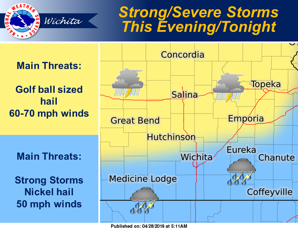
According to the National Weather Service, scattered showers and thunderstorms will develop this afternoon and evening throughout the area. Severe thunderstorms are possible north of U.S. Highway 400. Primary threats will be hail up to the size of golf balls and 60 mph
winds.
Areas to the south of U.S. Highway 400 will be more likely to have strong storms with isolated severe. Quarter sized hail will be more likely in this area.
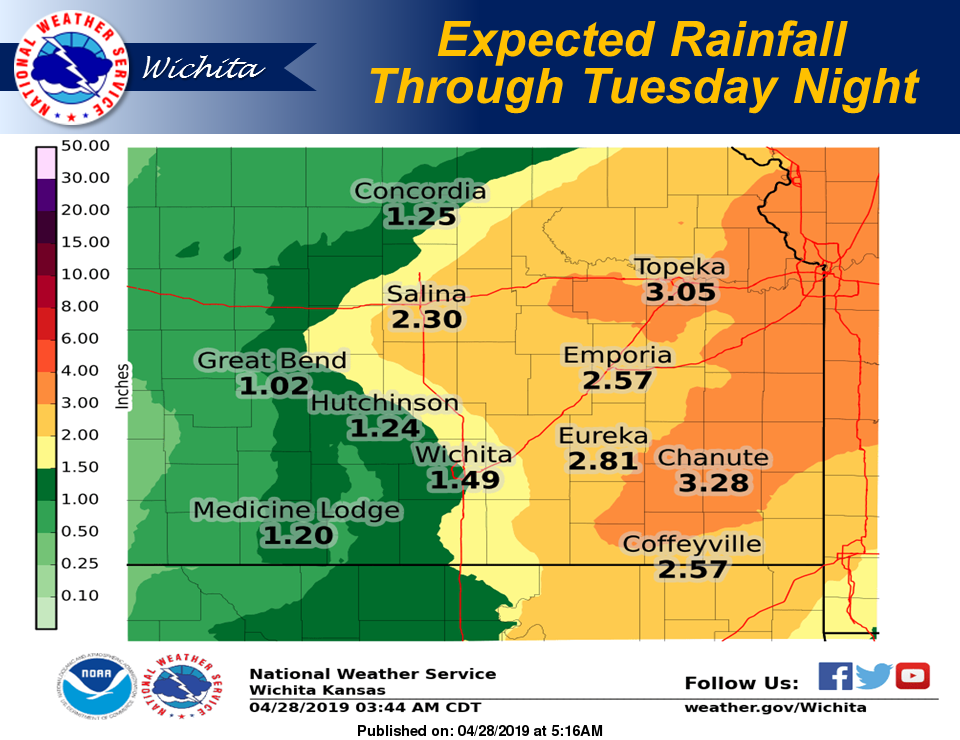 Multiple rounds of thunderstorms are in the forecast from Monday afternoon through Thursday. The main threat Monday into Tuesday will be the very heavy rain with the thunderstorm activity. Localized flooding is possible along and east of the turnpike through Tuesday night. Severe thunderstorms will also be possible
Tuesday night as well. The severe thunderstorms are expected along and east of the Butler and Cowley county lines. Quarter sized hail and 60 mph can be expected with the strongest storms.
Wednesday and into Thursday, showers and thunderstorms will continue to be light. Some of these storms could be locally strong with small hail and winds up to 50 mph possible. An isolated severe thunderstorm can`t be ruled out.